Jerry’s Map
On view through January 12, 2020
Intuit: The Center for Intuitive and Outsider Art
Chicago, Illinois
www.art.org
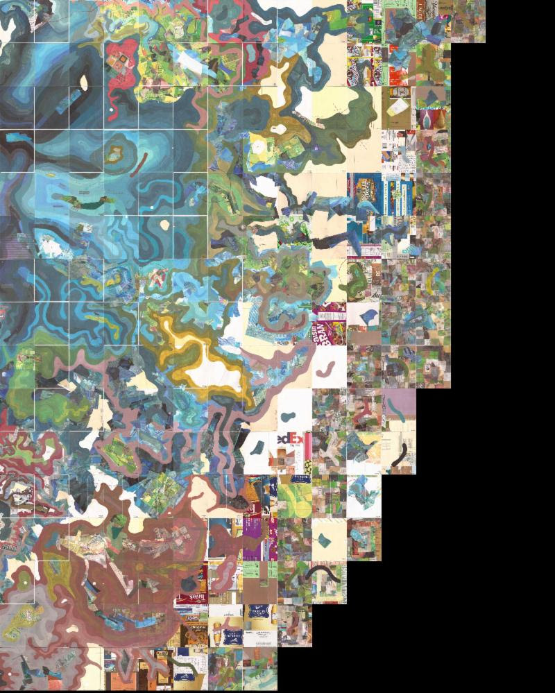
A lone doodle from 1963 has grown into the project of a lifetime for Michigan-based artist Jerry Gretzinger. The first piece of “Jerry’s Map” was made while he was bored, working at a ball bearing factory. This map-an ongoing project-now spans the length and width of a full-sized basketball court.
“Jerry’s Map” features selections from the map of his imaginary world. The vast project now consists of about 3,600 individual 8 x 10″ panels conjoined to make a single, large-scale map filled with cities, countryside, rivers, airports, railroads and other features representing everyday life in this imagined realm. The panels are executed in acrylic, marker, colored pencil, ink, collage and inkjet print on heavy paper. The oldest panels are at the center of the map, with new panels generated from the core outward and each panel labeled.
Credits: Jerry Gretzinger (American, b. 1942). Jerry’s Map: section LO viii-xi (multiple panels), 2017. Mixed media including inkjet print, collage, acrylic, marker and ink, 10 x 8 in. each panel. Collection of the artist.